Results
Field deployment in Peter Street Basin produced three things worth reporting: a detector that survives turbid water, a trajectory with detections registered in real basin coordinates, and a head-up display that turns those coordinates into a direction and a distance.
Detector training progression
Collapsing the label space did more for accuracy than any other single change, and adding underwater imagery did the rest.
| Configuration | Images | mAP50 | Precision |
|---|---|---|---|
| YOLOv8n, TACO, multi-class | 1,500 | 0.27 | 0.37 |
| YOLOv8s, TACO, single-class | 1,500 | 0.49 | 0.71 |
| YOLOv8s, combined, single-class | 12,177 | — | 0.921 |
TACO (terrestrial litter)
~1,500
TrashCan (underwater marine debris)
included
Collected by our team underwater
~1,000
Other public underwater repositories
remainder
Total training images
12,177
of which underwater scenes
5,720
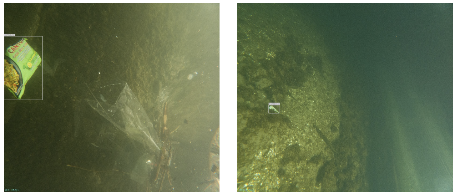
Qualitative underwater detections
These two frames show the range of appearance the model has to handle: partial occlusion, low contrast, and heavy colour shift from attenuation and scattering in basin water.
Basin mapping
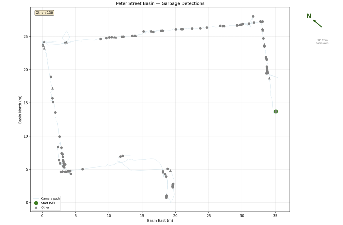
The COLMAP sparse reconstruction registered 796 of 823 above-water frames into one consistent model. Camera positions were extracted and transformed into basin coordinates through the ArUco anchor points. This run logged 130 detector hits, which are frame-level detection events along a continuous trajectory rather than 130 de-duplicated physical objects.
Head-up display output
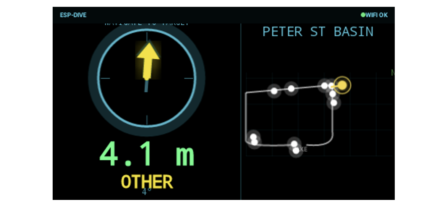
The goggles report the target class, a range of 4.1 m, a compass arrow toward the selected target, and a miniaturised basin map with registered detections.
Honest limitations
- Repeated observations of the same debris inflate raw detection counts unless track association or spatial clustering is applied, so the 130 hits in the plotted run are detection events, not 130 distinct objects.
- Underwater image degradation still causes false negatives for low-contrast or heavily occluded items.
- The dome port only partially corrects refraction, and COLMAP's intrinsic calibration was performed for the above-water camera only.
- The fixed transform between the above-water and underwater cameras (45°, 0.3 m) was measured roughly and propagates into underwater localisation error.
- The submarine's 5 m maximum depth and ~30 min battery constrain survey area and duration for larger or deeper water bodies.